Subject: United States & Mexico, Texas
Period: 1838-50 (circa)
Publication:
Color: Black & White
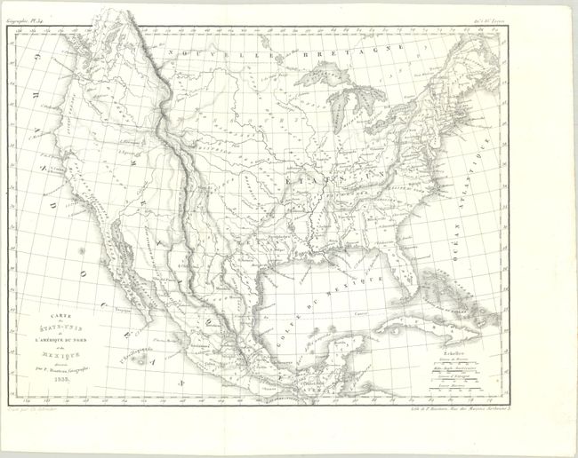
A. Carte des Etats-Unis de l'Amerique du Nord et du Mexique, by P. Bineteau, dated 1838 (11.2 x 9.0"). This scarce and elegantly engraved small map features the Republic of Texas, with its borders falling along the Rio del Norte (Rio Grande) and the Red River. Nouveau Mexique appears to the west of Texas, and to its north are various Indian districts. Mexico still controls much of the west. Two lakes, Tipanogos and Teguayo, are located in the vicinity of present-day Utah, with conjectural rivers branching from each to the Pacific. Two regions along the west coast are labeled Nouvelle Californie and Nouvel Albion. The map reflects the Oregon boundary dispute, with the District d'Oregon extending north of the map's neatline into present-day Canada. Engraved by Ch. Schreiber. Condition: Near fine, issued folding, with a tiny spot.
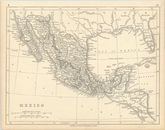
B. Mexico, by Chapman and Hall, circa 1850 (11.4 x 8.8"). This small map covers the region from the Red River south to Costa Rica and shows political divisions within Mexico. Texas and California are part of the United States and the border with Mexico follows the Gila River, suggesting a circa 1850 publication date. The map depicts place names, river systems and topography by hachure. Engraved by J.W. Lowry. Condition: On a faintly toned sheet.
References:
Condition: A
See description above.