Subject: Yellowstone, Wyoming
Period: 1881-1904 (circa)
Publication:
Color: Printed Color
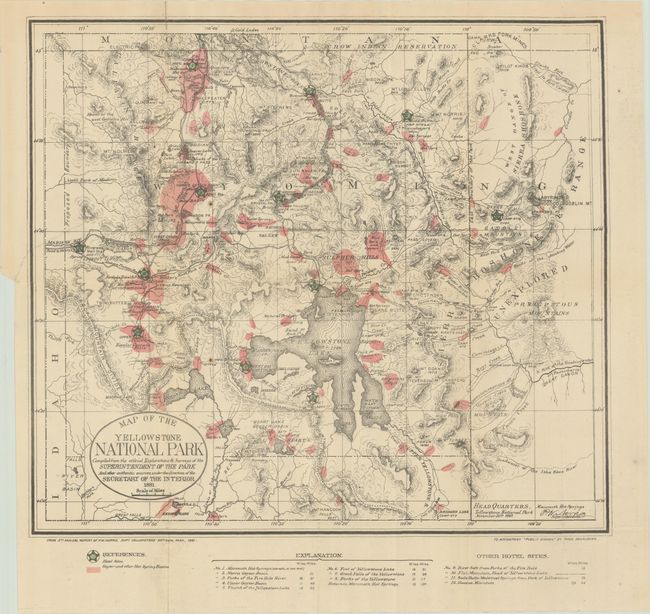
A. Map of the Yellowstone National Park Compiled from the Official Explorations & Surveys of the Superintendent of the Park..., by Thomas Donaldson, from Public Domain, dated 1881 (17.4 x 15.5"). This map is from the 5th Annual Report of P.W. Norris, Superintendent of Yellowstone National Park, and reissued in Donaldson's Public Domain. The map itself is very detailed and locates the Upper, Shoshone, Gibbon, and Heart Lake Geyser Basins, Mud Geysers, and Mammoth Hot Springs to name a few. It shows geysers and hot springs in pink and planned hotel sites (12 in all) marked with large green stars. Topography is indicated through hachure. This map provides an early look at Yellowstone and the government plans for its development. Condition: Issued folding with a couple rust spots and tiny separations at the fold intersections that have been backed with archival tape. There is a binding tear entering 2" into map image at left that has been closed with archival tape on verso. (B+)
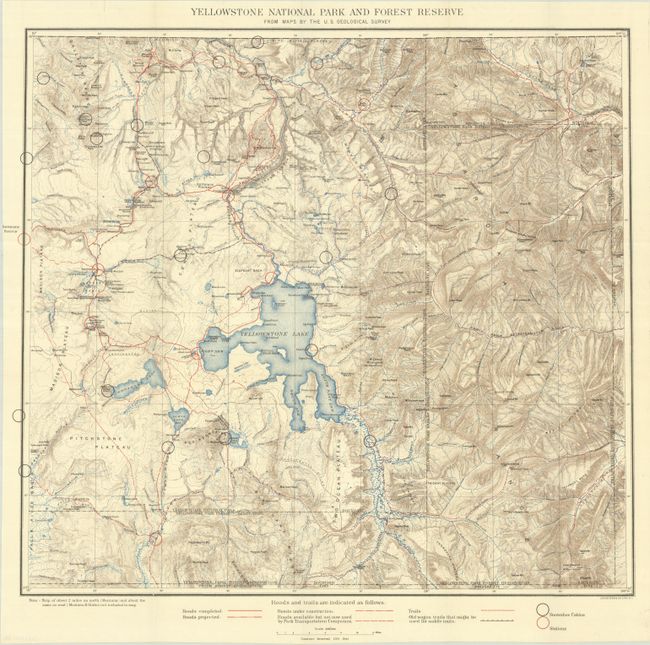
B. Yellowstone National Park and Forest Reserve from Maps by the U.S. Geological Survey, by U.S. Geological Survey (USGS), circa 1890 (19.9 x 18.0"). This finely detailed topographical map shows all of Yellowstone Park plus the region to the east up to Bighorn County, in today's Park County. It has good topographical detail with contour intervals at 100 feet at a scale of 1 inch = 4 miles. The Upper, Shoshone, Gibbon, and Heart Lake Geyser Basins, Mud Geysers, Mammoth Hot Springs are named. Old Faithful Hotel is noted. Condition: Crisp and colorful, issued folding. (A+)
The lot also includes 8 pages of text on the park excerpted from a government report, published December 1883.
References:
Condition:
See description above.