Subject: Richmond, Virginia
Period: 1864 (circa)
Publication:
Color: Printed Color
Size:
14.4 x 16.4 inches
36.6 x 41.7 cm
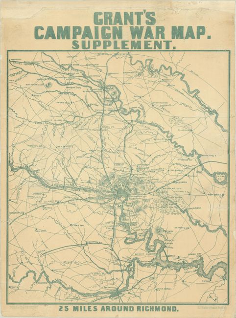
This rare Civil War-era broadside centers on a grid plan of the capital of the Confederacy, Richmond, with concentric circles radiating out from the city in 5 mile increments. It extends from Pole Cat Station (30 miles north of the city) south to Petersburg, and from Beaver Dam Creek east to the New Kent Courthouse. There are plenty of place names, and the map locates rivers, bridges, courthouses, stations, roads, railroads, and more. There are multiple notes of Sherman capturing stations north of Richmond; the mapmaker appears to have mistaken Gen. Philip Sheridan for Sherman. The map appears to chronicle in its own crude way Sheridan's raid on Richmond. A "Fight with J.E.B. Stuart" perhaps refers to the Battle of Yellow Tavern (May 11, 1864), where Stuart was mortally wounded by one of Sheridan's dismounted cavalrymen. Sheridan is only correctly identified when his camp is noted west of Coal Harbor (Cold Harbor). Published in Boston.
References:
Condition: B+
This example has been backed in linen, repairing some edge tears, the longest of which extends 3.5" into map image at left. There is light soiling. The map's upper margin above the title has been extended with old paper, and several smaller edge chips have also been replaced with old paper.