Subject: Vermont
Period: 1827 (published)
Publication: A Complete Historical, Chronological, and Geographical American Atlas
Color: Black & White
Size:
9.4 x 12.3 inches
23.9 x 31.2 cm
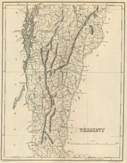
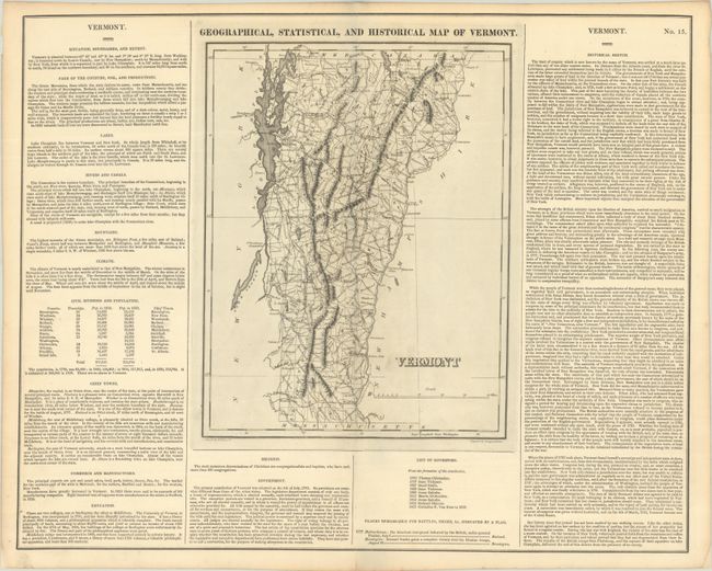
This map of the Green Mountain State is on a full folio sheet (21.9 x 17.5") with surrounding text describing boundaries, climate, chief towns, religion, commerce, government, history, and more. The map delineates twelve counties, and highlights the two principle battle sites from the War of 1812 at Hubbardstown and Bennington with small flags. A list of governors beneath the map spans from Thomas Chittenden in 1793 to Cornelius P. Van Ness in 1826. Drawn by Fielding Lucas Jr. and engraved by Young and Delleker.
This is the first time we have encountered this map in black & white.
References: Phillips (Atlases) #1177-15.
Condition: A
A crisp impression on a clean sheet with a tiny repaired centerfold separation confined to the bottom blank margin.