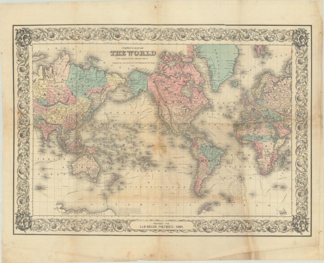
Subject: World
Period: 1856 (dated)
Publication:
Color: Hand Color
Size:
27.8 x 19.8 inches
70.6 x 50.3 cm
A beautifully engraved double-page map of the world with a focus on explorations and discoveries to date. The sheet is centered on North America; Canada named British Possessions, Alaska is Russian America. Tasmania is also called Van Diemans Land. Antarctica is beginning to take shape with the coast delineated between Cook's landing of 1773 and Vincenne's in 1840, naming Repulse Bay, Termination Land, Knox's High Land, Budd's High Land, Sabrina Land, Totten's Land, Porpoise Bay, Clarie Land, and Adelia Land. A small length of coast is also defined as Graham's Land. A superb map that shows the state of the world in 1855. The map features fine original hand coloring and Colton's distinctive scroll-style border. Dated 1855, this map was first published in the first edition of Colton's monumental world atlas. This slightly larger, separately issued edition was prepared for J. & H. Miller, Columbus, Ohio.
References:
Condition: B
Issued folding with full contemporary color. There are short separations, a couple of small holes in the south Atlantic, a few stains, and some extraneous creasing. A short tear in Africa has been closed on verso with cello tape.