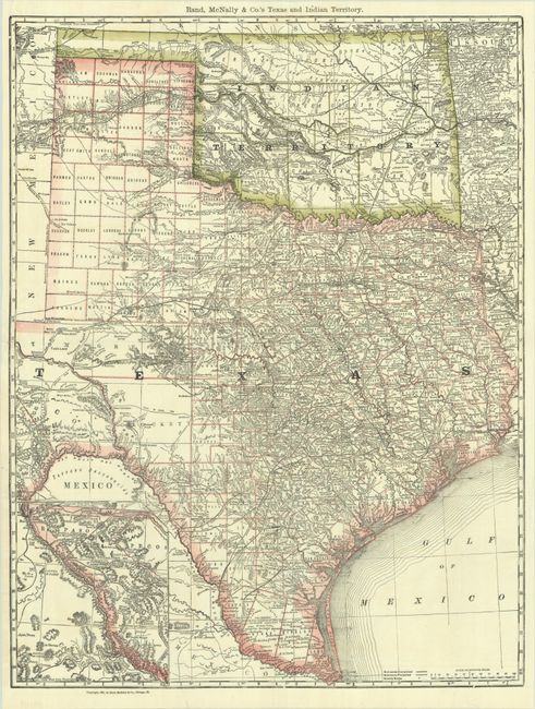
Subject: Texas & Oklahoma
Period: 1881 (dated)
Publication:
Color: Printed Color
Size:
19.1 x 24.9 inches
48.5 x 63.2 cm
This atlas map of Texas and Indian Territory shows great detail of the more settled eastern half of the state with explorer tracks, roads, and railroads extending to West Texas. Despite the 1881 date, county configuration is current to 1883-84, with newly organized counties like Hardeman, Zavala, Martin, and Edwards located. Greer County is properly shown in Indian Territory with notes showing the disputed boundary claims by the United States and Texas. The various tribal lands of Indian Territory are delineated.
References:
Condition: A
A bright, clean example, issued folding, with minor extraneous creasing and a few short fold separations that have been closed with archival tape on verso.