Subject: Tennessee
Period: 1827 (published)
Publication: A Complete Historical, Chronological, and Geographical American Atlas
Color: Black & White
Size:
18.6 x 11.4 inches
47.2 x 29 cm
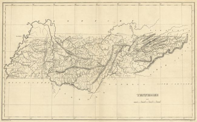
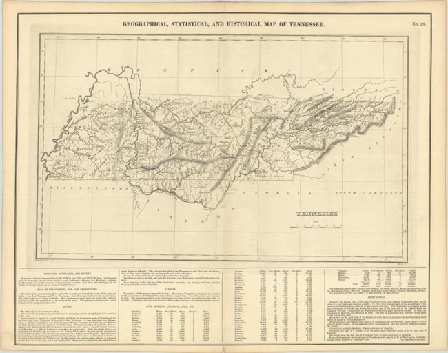
The map is on a full folio sheet (21.9 x 17.5") with English text below giving a brief description of Tennessee's boundaries, productions, rivers, climate, chief towns, and population statistics by county. The finely engraved map delineates rivers, roads, counties, and major towns. County configuration is current to the published date and includes Fayette County in the southwest (established in 1824). Cherokee Lands is located in the southeastern portion of the state. Kentucky and Tennessee are almost always shown on the same map, so it is uncommon to find Tennessee alone during this period. Drawn by Fielding Lucas, Jr. and engraved by Kneass.
This is the first time we have encountered this map in black & white.
References: Phillips (Atlases) #1177-28.
Condition: A
A crisp impression on a clean sheet.