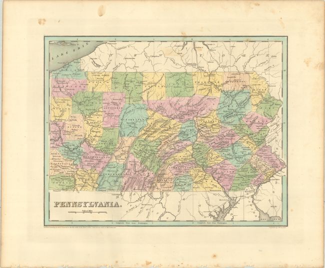
Subject: Pennsylvania
Period: 1838 (dated)
Publication: An Illustrated Atlas, Geographical, Statistical, and Historical, of the United States...
Color: Hand Color
A. Pennsylvania (14.5 x 11.4"). An attractive, early map of the state that details county seats, towns and settlements, and river systems. County development is current to the copyright date on the map, just prior to the organization of Clinton and Clarion counties. The early transportation network is evident with several railroads extending out from Philadelphia, canals emerging in the western portion of the state, and the National Road extending from Cumberland, MD to Washington County. Not to be confused with the maps from the Comprehensive Atlas, this map is several inches larger and carries much more information. Engraved by G. W. Boynton.
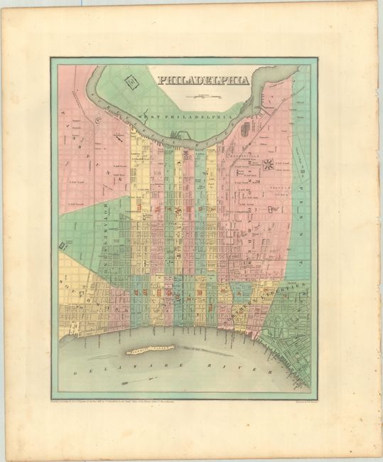
B. Philadelphia (11.3 x 14.4"). A detailed city plan laying out the street grid pattern and numerous buildings including the State Penitentiary, Girard College, County Prison, Alms House, and the Navy Yard. North is oriented to the right.
References: Phillips (Atlases) #1381; Ristow pp. 270-271.
Condition:
Crisp impressions with contemporary color. There is minor foxing mostly in the blank margins. Pennsylvania (B+) / Philadelphia (A)