Subject: Oregon
Period: 1906-18 (circa)
Publication:
Color: Printed Color
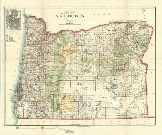
A. State of Oregon Compiled from the Official Records of the General Land Office and Other Sources..., by General Land Office, from Sen. Doc. 194, 59th Congress, 2nd Session, dated 1906 (18.2 x 14.3"). This fine map depicts the extent of public surveys in Oregon. It is densely filled with information including railroads, Indian reservations, military reservations, forests, the location of land offices, and more. Townships containing "workable coal" are colored in orange and townships "probably containing workable coal" in blue. A plan view of Portland appears in an inset at top left. Compiled by M. Hendges, revised by A.F. Dinsmore. Traced and lettered by William Bauman Jr. Condition: Crisp and clean, issued folding with a few short fold separations mostly in the margins.
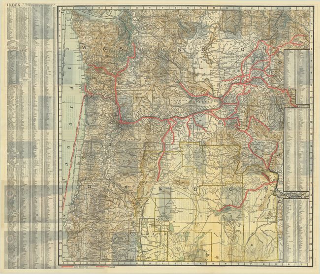
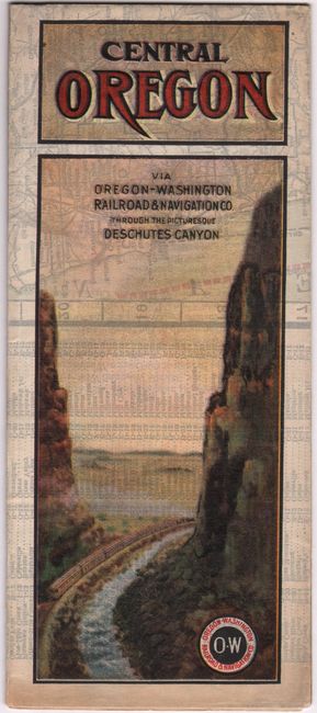
B. Central Oregon Via Oregon-Washington Railroad & Navigation Co. Through the Picturesque Deschutes Canyon, by Poole Bros., circa 1918 (22.5 x 23.0"). This scarce railroad map of the state delineates Oregon-Washington Railroad routes with a bold red line. Projected routes and routes under construction are also located. The Portland Steamship Company's route is shown in red dotted line. The map features excellent topographical detail and identifies towns and cities, counties, Indian reservations, roads, and more. It is laid out on a grid with a corresponding alphabetical index at left and right. Verso features black & white photos and text describing the state. Self-folding into pictorial wrappers (4.1 x 9.4"). Condition: Issued folding with a hint of toning.
References:
Condition: A
See description above.