Subject: Tulsa, Oklahoma
Period: 1955 (dated)
Publication:
Color: Printed Color
Size:
18.3 x 23.4 inches
46.5 x 59.4 cm
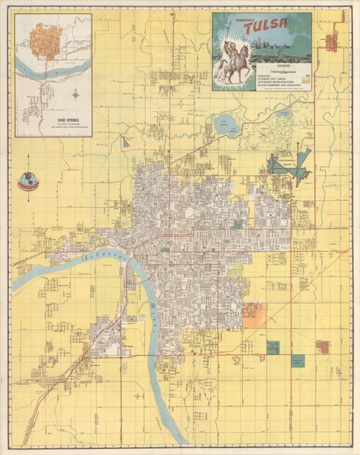
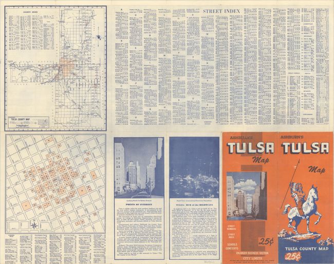
This detailed and early street map of Tulsa was published by J. Foster Ashburn. It extends from the Tulsa Municipal Airport south to Southern Hills Country Club and beyond the Arkansas River to West Tulsa. Areas shaded in orange represent adjoining municipalities, the large areas in yellow are outside the city limits of Tulsa, and the green areas indicate open spaces including cemeteries, airports, and Skelly Stadium. An inset at top left presents a city plan for Sand Springs, which is located about 7 miles west of Tulsa. Decorated by a title cartouche featuring a Native American on horseback with the city skyline in the background. The verso features smaller maps of downtown and Tulsa County along with a comprehensive street index. Self-folding with an illustration of a mounted Native American on the front cover.
Ashburn was based out of Fort Worth and mostly produced maps of cities in Texas and the South. Unlike most mapmakers of the period, Ashburn was “vertically integrated,” handling all the production work in house, including printing.
References:
Condition: A
Clean and colorful, issued folding.