Subject: Sag Harbor, New York
Period: 1891 (dated)
Publication:
Color: Printed Color
Size:
22.5 x 24.7 inches
57.2 x 62.7 cm
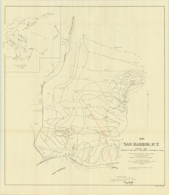
A detailed chart of Sag Harbor on the eastern side of Long Island. It shows detailed soundings and the proposed breakwater in red overprinting subsequently constructed in 1908. The chart also illustrates some of the structures along the shore of the town of Sag Harbor and Conklin’s Point. Features a large inset map of the "Vicinity of Sag Harbor" at top left. At the time, Sag Harbor was transitioning from its storied past as the first port of entry to the new United States (1789), and later whaling center, to becoming the summer retreat for wealthy New Yorkers.
References:
Condition: A
Issued folding on a clean sheet with one tiny archival repair in the left blank margin.