Subject: New York City, New York
Period: 1866 (dated)
Publication:
Color: Black & White
Size:
26.7 x 30.7 inches
67.8 x 78 cm
The Office of Coast Survey is the oldest U.S. scientific organization, dating from 1807 when Congress directed that a "survey of the coast" be carried out. By 1836, it was called the U.S. Coast Survey and in 1878, the name was changed to the U.S. Coast and Geodetic Survey. Today the Office of Coast Survey is a division of the National Oceanic and Atmospheric Administration NOAA.
The survey teams, composed of civilians as well as Army and Naval officers, charted the nation's waterways and produced a wide array of reports, survey charts, hydrographic studies of tides and currents, astronomical studies and observations, and coastal pilots. These charts are an important record of the changing nature of the nation's coastlines. In additional to coastal charts, the U.S. Coast and Geodetic Survey produced land sketches, Civil War battle maps, and the early aeronautical charts.
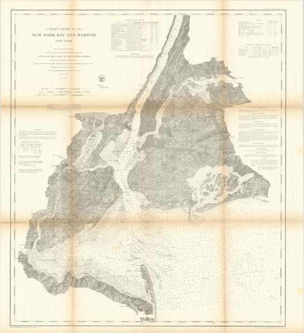
This is the earliest edition of this great coastal chart showing Sandy Hook, Raritan Bay, Staten Island, Brooklyn, Manhattan, and the New Jersey shore along the Hudson River. Hundreds of depth soundings are depicted in the bay and into the Hudson and East Rivers. The chart includes detailed sailing directions and navigational notes on channels, lighthouses, buoys, and beacons.
References:
Condition: B
Issued folding with light to moderate toning along the folds, a couple of minor spots, and some short fold separations that have been closed on verso with archival tape.