Subject: Missouri
Period: 1838 (dated)
Publication: An Illustrated Atlas, Geographical, Statistical, and Historical, of the United States...
Color: Hand Color
Size:
14.5 x 11.7 inches
36.8 x 29.7 cm
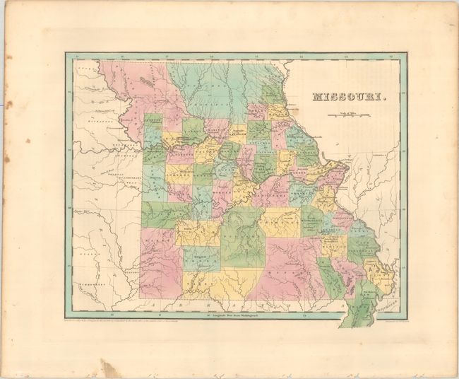
This handsome atlas map depicts the state just prior to the "Honey War" with Iowa Territory. County configuration is roughly current to 1837, with the newly acquired Platte Country in the northwest. The vast central portion of the Platte Purchase is unnamed and "attached to Clinton." The map was likely completed in early 1837 as the new counties of Livingston, Linn and Macon do not appear on the map. The area beyond the state's western border is labeled Indian District. Independence, St. Louis, and Jefferson City are all identified. Engraved by G.W. Boynton.
References: Phillips (Atlases) #1381; Ristow pp. 270-271.
Condition: B+
A crisp impression with contemporary color. There is minor foxing mostly in the blank margins.