Subject: Northern Michigan
Period: 1906 (dated)
Publication:
Color: Printed Color
Size:
28 x 21.8 inches
71.1 x 55.4 cm
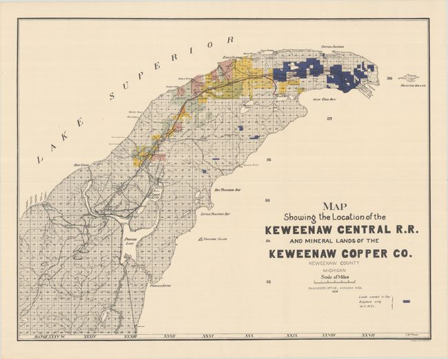
This rare map presents the Keweenaw Central Railroad in Michigan’s far Upper Peninsula. The railroad was developed by the Keweenaw Copper Company in 1905 to access numerous mines and prospective claims in the area. The new company took over operations of the Lac La Belle & Calumet Railroad, converted the line to standard gauge, and ultimately extended the route to connect Mandan in the north with Calumet in the south. Bright red lines indicated the completed sections of the railroad while dotted lines indicate those either under construction or proposed. Land claims are highlighted in various colors and numerous mines dot the area along either side of the track. Despite the high concentration of copper in the vicinity, the Keweenaw Central Railroad failed in 1918 and much of the trackage was ripped up the following year. Signed in the plate by J.B. Power and printed by C.P. Gray in New York. We found no other examples for sale in the last 30 years and only three examples on OCLC, including the University of Michigan and the Detroit Public Library.
References:
Condition: A
On a bright sheet with some faint creasing.