Subject: Provincetown, Massachusetts
Period: 1876 (dated)
Publication:
Color: Black & White
Size:
18.1 x 8.6 inches
46 x 21.8 cm
This group of four government survey maps and sketches document harbor improvements and coastal change at Provincetown Harbor.
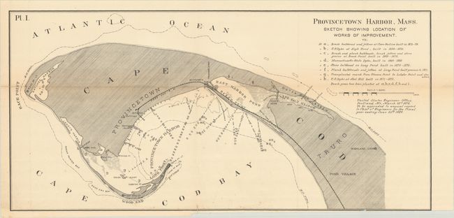
A. Provincetown Harbor, Mass. Sketch Showing Location of Works of Improvement. A detailed survey map illustrating harbor improvements undertaken between 1869-75, including shoreline stabilization and navigational enhancements in support of the fishing and maritime economy. Condition: There is a binding trim at bottom with associated short archivally repaired binding tear. (B+)
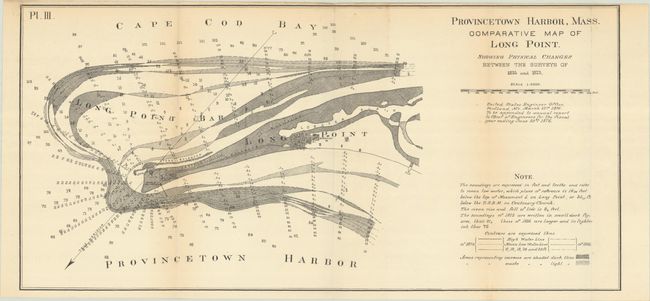
B. Provincetown Harbor, Mass. Comparative Map of Long Point. Showing Physical Changes Between the Surveys of 1835 and 1873. Locates the lighthouse, battery and barracks and graphically documents nearly forty years of coastal accretion and shoreline movement at Long Point, one of Cape Cod’s important coastal features. Condition: Minor toning along the fold lines. (B+)
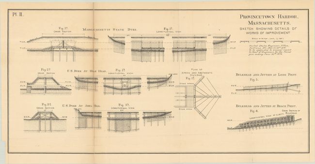
C. Provincetown Harbor, Massachusetts. Sketch Showing Details of Works of Improvement. Condition: The left panel was completely separated and reattached on verso with archival tape. (B)
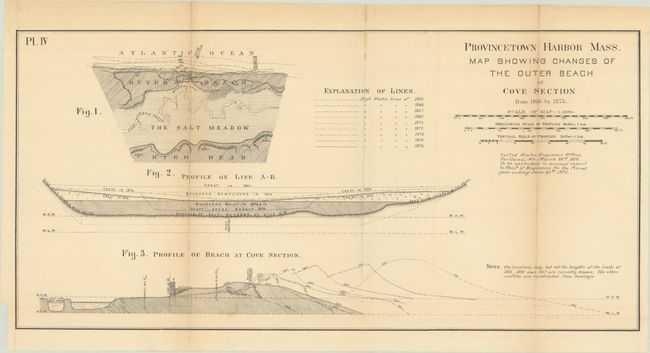
D. Provincetown Harbor Mass. Map Showing Changes of the Outer Beach at Cove Section from 1835 to 1875. Condition: Minor toning along the fold lines. (B+)
References:
Condition:
Issued folding. See description above for details.