Subject: World
Period: 1780 (circa)
Publication: Atlas de Toutes les Parties Connues du Globe Terrestre
Color: Hand Color
Size:
13 x 8.5 inches
33 x 21.6 cm
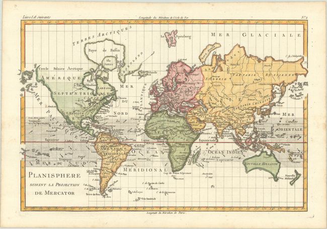
Attractive copper-engraved map of the world with the direction of ocean currents shown throughout with little arrows. Alaska, here Alaschka, is depicted as a small island in an archipelago, and Tasmania is still attached to a truncated Australia.
Rigobert Bonne was an important French cartographer of the late 18th century. In 1773 he succeeded Jacques Bellin as the royal cartographer in the Office of the Hydrographer at the Depot de la Marine. Working in his official capacity, Bonne compiled some of the most detailed and accurate maps of the period.
References:
Condition: A
A crisp impression on a bright sheet with minor foxing that is mostly confined to the blank margins.