Subject: Boston, Massachusetts
Period: 1887 (dated)
Publication:
Color: Hand Color
Size:
20 x 26.2 inches
50.8 x 66.5 cm
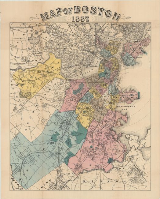
This rare and detailed map of Boston and environs shows streets, railroads, parks, cemeteries, and more. It extends from Everett south to Quincy and identifies several towns in the Greater Boston area. The map features 25 numbered and colored sections; the corresponding key is not present with this example and may have appeared on an opposing page of text. This is the only example of this map that we have found on the market. There is no identifying publisher's imprint, but it is possible that it was included in a local directory.
References:
Condition: B+
Issued folding, now flat, with light, uneven toning and archival repairs to some small separations and holes along the folds.