Subject: Massachusetts, Boston
Period: 1838 (dated)
Publication: An Illustrated Atlas, Geographical, Statistical, and Historical, of the United States...
Color: Hand Color
Size:
14.4 x 11.3 inches
36.6 x 28.7 cm
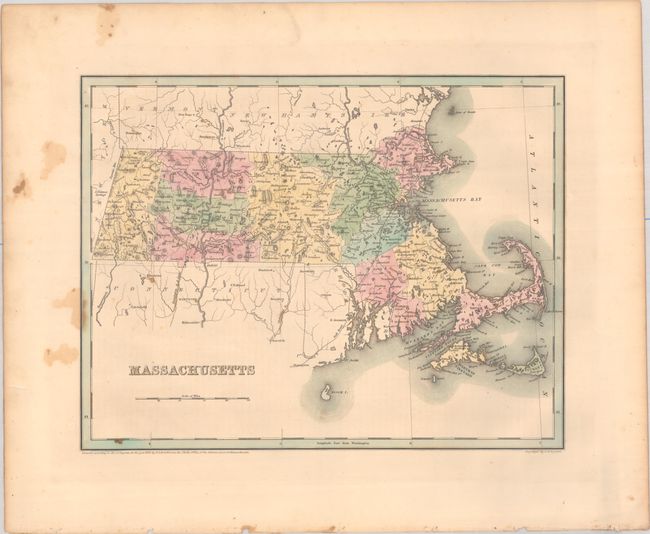
Massachusetts. An attractive, early map of the state that details county seats, towns and settlements, and river systems. County development is current to the copyright date on the map with 14 counties. The railroad network stretches throughout the state and extends to both Maine and Connecticut. Not to be confused with the maps from the Comprehensive Atlas, this map is several inches larger and carries much more information. Engraved by G. W. Boynton.
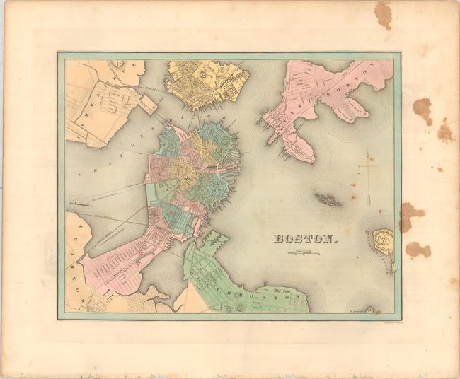
Boston. A handsome and detailed plan of the city prior to filling in the Back Bay. Extends to include South Boston, Roxbury, Cambridge, Charlestown, and East Boston. Names several bridges and railroads leading into the city.
References: Phillips (Atlases) #1381; Ristow pp. 270-271.
Condition:
Crisp impressions with contemporary color. There is staining and foxing that is mostly in the blank margins. Massachusetts (B+) / Boston (B)