Subject: Baltimore, Maryland
Period: 1928 (dated)
Publication:
Color: Printed Color
Size:
20.1 x 15.5 inches
51.1 x 39.4 cm
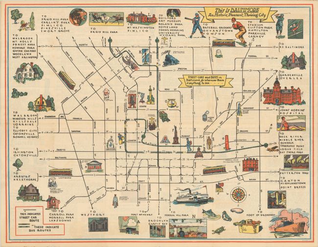
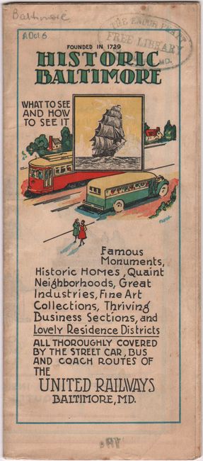
This scarce pictorial map of downtown Baltimore was published by the United Railways & Electric Company. It covers the area from North Avenue south to Conway Street and from Fremont Avenue east to Caroline Street with street car and bus routes highlighted in green and black overprinting. Illustrations throughout the map highlight the city's attractions including Fort McHenry, Washington Monument, the grave of Edgar Allen Poe, The Shot Tower, and more which are keyed to descriptions on verso. Banner text at center further promotes that "STREET CARS and BUSES in Baltimore go wherever there is anything to see." Self-folding with pictorial wrappers (3.5 x 8.0") with alternate title Historic Baltimore - What to See and How to See It.
References: Rumsey #14063.
Condition: A
Issued folding with a hint of toning. Pamphlet cover has the stamp of the Enoch Pratt Free Library.