Subject: Maryland, Baltimore
Period: 1838 (dated)
Publication: An Illustrated Atlas, Geographical, Statistical, and Historical, of the United States...
Color: Hand Color
Size:
14.5 x 11.3 inches
36.8 x 28.7 cm
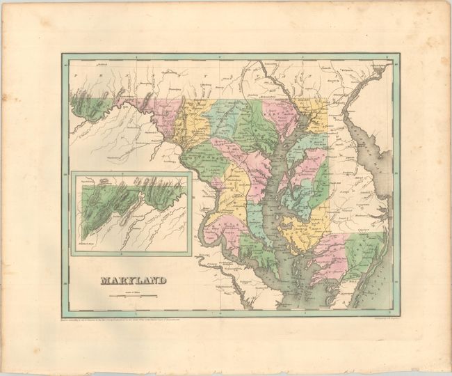
Maryland. An attractive, early map of the state that details county seats, towns and settlements, and river systems. County development is current to the copyright date on the map, just after the established of Carroll County in 1837. Early roads and railroads are shown throughout the map, and an inset illustrates the western tip of the state. Not to be confused with the maps from the Comprehensive Atlas, this map is several inches larger and carries much more information. Engraved by G. W. Boynton.
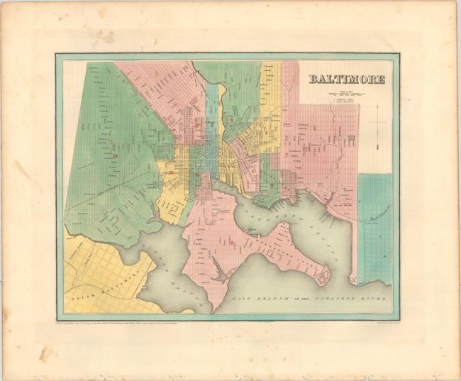
Baltimore. A detailed plan laying out the street grid pattern and dividing the city into 12 wards. Locates Fort McHenry, City Hall, Cathedral, Center Market, Baltimore College, and more.
References: Phillips (Atlases) #1381; Ristow pp. 270-271.
Condition: B+
Crisp impressions with contemporary color. There is minor foxing mostly in the blank margins.