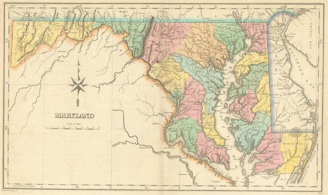
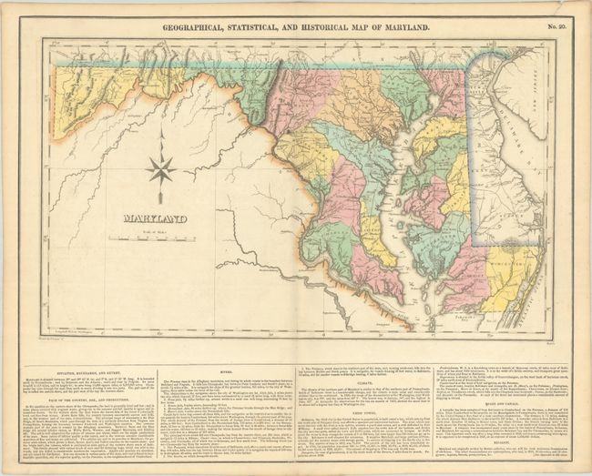
Subject: Maryland
Period: 1827 (published)
Publication: A Complete Historical, Chronological, and Geographical American Atlas
Color: Hand Color
Size:
19 x 11.3 inches
48.3 x 28.7 cm
This map of Maryland is on a full folio sheet (21.9 x 17.5") with text below describing boundaries, agricultural output, climate, important towns and cities, and more. Counties are up to date, and several towns and cities, rivers, and roads are shown. Battlefields of the War of 1812 are noted, including Bladensburg, Frenchtown, and just outside of Baltimore. Washington, D.C. is prominently displayed, with Georgetown and the capitol noted within its borders. Delaware appears in its entirety as well. An elegant compass rose appears in the blank interior of Virginia. Drawn by Fielding Lucas, Jr. and engraved by Boyd.
References: Phillips (Atlases) #1177-20.
Condition: A
Contemporary color on a clean sheet with a couple of small edge tears in the top blank margin that have been closed on verso with archival tape.