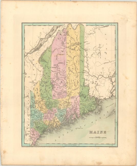
Subject: Maine
Period: 1838 (dated)
Publication: An Illustrated Atlas, Geographical, Statistical, and Historical, of the United States...
Color: Hand Color
Size:
11.2 x 14.4 inches
28.4 x 36.6 cm
An attractive, early map of the state that details county seats, towns and settlements, and river systems. County development is current to the copyright date on the map with the addition of Franklin and Piscataquis counties. There are a few interesting notations regarding the state's boundaries: "True Boundary According to the Treaty of 1783;" "Line as Proposed by the King of the Netherlands;" and, farther south, "Line Claimed by Great Britain." Not to be confused with the maps from the Comprehensive Atlas, this map is several inches larger and carries much more information. Engraved by G. W. Boynton.
References: Phillips (Atlases) #1381; Ristow pp. 270-271.
Condition: B+
Contemporary color with minor foxing that is mostly in the blank margins.