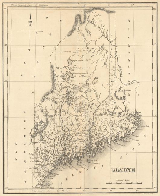
Subject: Maine
Period: 1827 (published)
Publication: A Complete Historical, Chronological, and Geographical American Atlas
Color: Black & White
Size:
9.7 x 12 inches
24.6 x 30.5 cm
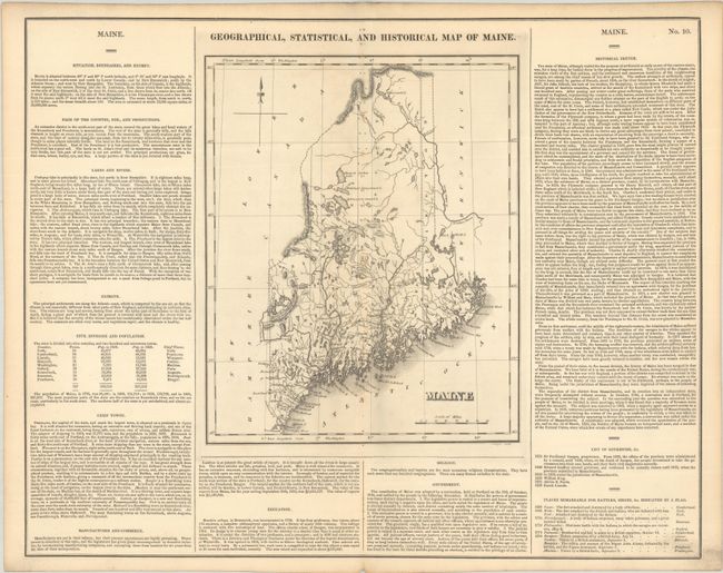
This map of the new state of Maine was beautifully engraved by J. Yeager. It shows the state with only nine counties and a population of less than 300,000, and was engraved just prior to the organization of Waldo County in 1827. There is good detail of the extensive system of lakes and rivers. Wagon roads are limited to the southern portion, most connecting the coastal towns. Bangor and Canaan, as well as many small villages are named. A handsome map on a full folio sheet (21.9 x 17.5") with surrounding text giving historical, physical, and political information. A table lists all governors current to Enoch Lincoln, 1826. From 1652 to 1820, Maine was under the jurisdiction of Massachusetts.
This is the first time we have encountered this map in black & white.
References: Phillips (Atlases) #1177-10.
Condition: B
A crisp impression on a clean sheet with numerous small binding holes along the centerfold.