Subject: Kansas
Period: 1875 (dated)
Publication:
Color: Hand Color
Size:
48.6 x 28 inches
123.4 x 71.1 cm
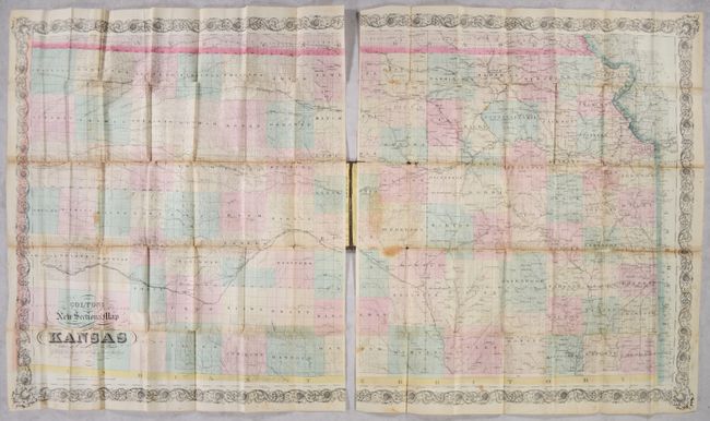
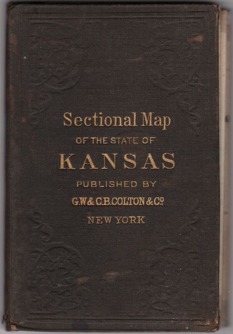
This scarce pocket map of the state is printed on two sheets, each measuring approximately 24 x 28" as issued. County configurations are current to about 1874 when Edwards County was created out of Kiowa County in the southwestern part of the state. Here Edwards' new borders are properly shown but the county is yet to be named. Almost the entire state has been surveyed at this point though development is primarily in the east, including a well-developed railroad network. Other details include county seats, forts, towns and villages, rivers, and more. Drawn on an impressive scale of 9 miles per inch. Printed on banknote-style paper with decorative borders and fancy titling. Folds into original brown cloth bords with gilt title on the front cover (4 x 6").
References:
Condition: B
Issued folding with contemporary color and some light staining and foxing. A number of fold separations have been closed on verso with old tape with some minor staining visible on recto. There are small losses at three fold junctions on the right sheet. Covers have light wear.