Subject: Chicago, Illinois
Period: 1920 (circa)
Publication:
Color: Printed Color
Size:
18.9 x 32.6 inches
48 x 82.8 cm
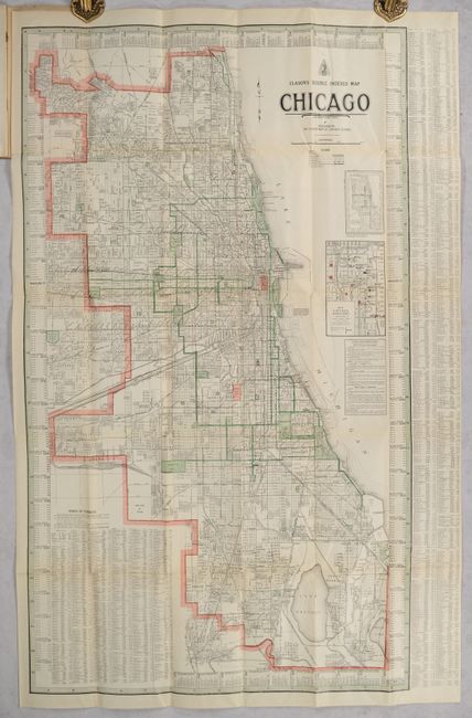
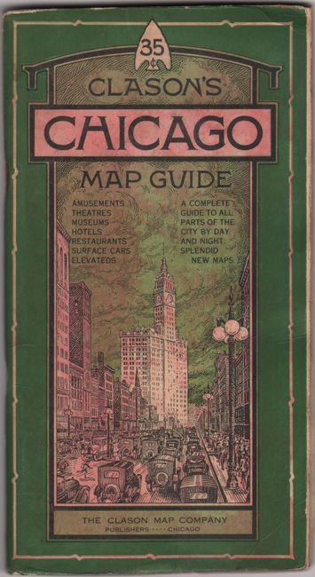
This detailed map of Chicago from the "Green Guide Series" would have been a great asset to any visitor to the Windy City at the beginning of the Roaring Twenties. It identifies streets, boulevards, car lines, railroads, elevated railways, and car lines and is surrounded by a street index. Below the title, a diagram illustrates the street numbering system, and "Clason's Instantaneous Index" provides helpful tips such as how to find any house number. An inset zooms in on the business district. The map folds into the back cover of a 80-page booklet, Clason's Wise Owl Guide to Chicago by Day and Night, which is full of information and illustrations. Alternate title on the illustrated stiff paper covers (4.0 x 7.5"): Clason's Chicago Map Guide.
References:
Condition: B+
The folding map is very good with a few short fold separations and minor extraneous creasing. Covers have light wear.