Subject: Central Colorado, Denver
Period: 1942 (dated)
Publication:
Color: Printed Color
Size:
16.8 x 10.9 inches
42.7 x 27.7 cm
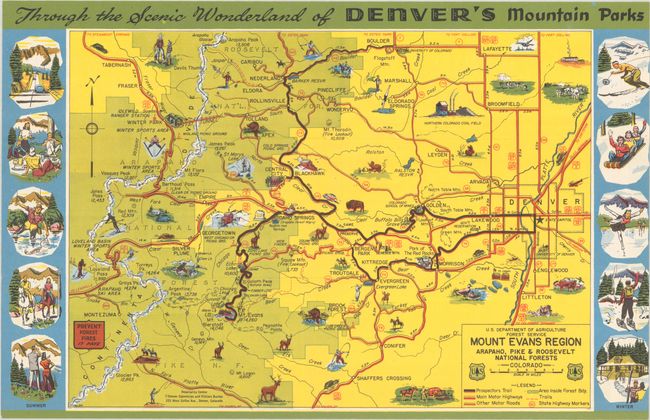
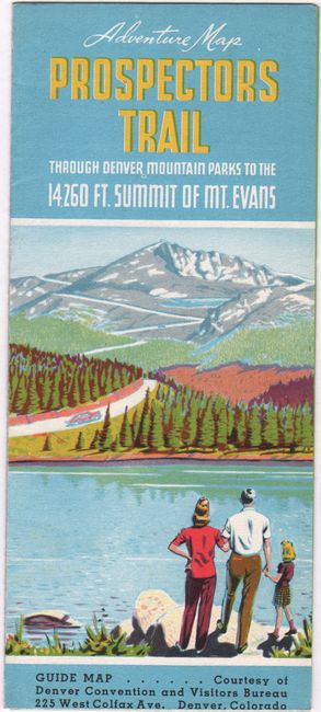
This wonderful pictorial map extends from Loveland Basin east to Denver and from Boulder south to Shaffers Crossing. Images of skiing, outdoor recreation, wildlife, and more pepper the landscape. A key identifies prospectors trails, highways and other roads, nation forest areas, trails, and state highway markers. Various peaks are named along with their elevation. The map is surrounded by ten vignettes, with summer activities on the left and winter activities on the right. Signed "F. F." and dated May 1942. Self-folds into brochure with an illustrated cover (3.7 x 8.5") and the title "Adventure Map Prospectors Trail Through Denver Mountain Parks to the 14 260 Ft. Summit of Mt. Evans." Printed by Smith-Brooks Printing Co. in Denver.
References:
Condition: A+
Colorful and fine. Issued folding.