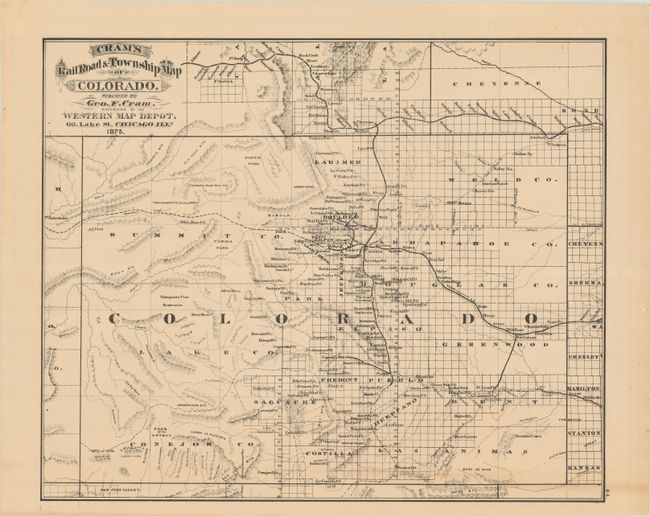
Subject: Colorado & Nevada
Period: 1875 (dated)
Publication: Cram's Standard American Atlas of the United States
Color: Black & White
Size:
18.8 x 15.4 inches
47.8 x 39.1 cm
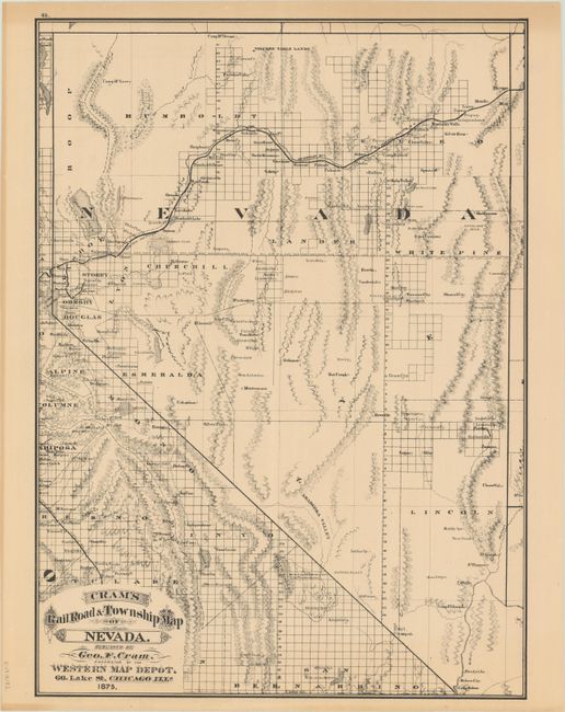
Scarce map from the first edition of Cram's most celebrated atlas. The map features early county development to 1870, prior to the organization of Platte County in 1872 (which was abolished in 1874) and Elbert, Grand, Hinsdale, La Plata, and Rio Grande in 1874. Filled with many interesting city and place names including the mining areas. The railway system is fairly well developed; all main railways are named with spurs extending to Las Animas, Canyon City, Central City and Burlington. The map extends north to include the railways in western Nebraska and southern Wyoming. The fine "Cram's Railroad & Township Map of Nevada" is on verso, with county configuration also current to 1870. The imprint is Cram's Western Map Depot, 66 Lake St. Chicago, Ills. There was a close relationship between the Cram and Watson firms, who also published from this address. This Lake Street address was the home to Cram's publishing company between 1873 and 1879, thereafter moving to Wabash Avenue.
References:
Condition: B+
A crisp impression on a sturdy sheet with a few faint spots and a bit of toning at bottom.