Subject: Los Angeles, California
Period: 1907 (dated)
Publication:
Color: Black & White
Size:
20.6 x 27 inches
52.3 x 68.6 cm
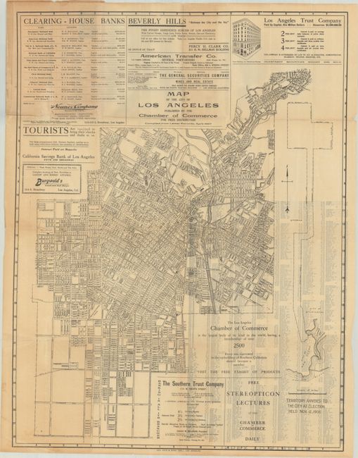
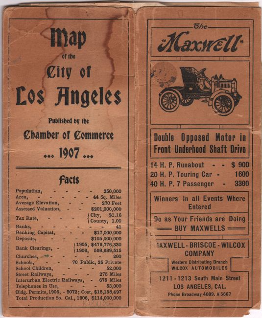
An early and detailed street map of Los Angeles published by George Rice & Sons. Extends from Pasadena Avenue south to Manchester Avenue and locates parks, cemeteries, country clubs, railroad yards, and more. With a long inset map at right entitled “Territory Annexed to the City at Election Held Nov. 12, 1907.” Various advertisements fill the spaces at top and bottom including “Beverly Hills ‘Between the City and the Sea’ The Finest Residence Suburb of Los Angeles.” Folds into stiff paper covers with facts about Los Angeles, including its population of 250,000 and 53,000 telephones in use. The rear cover features an illustrated advertisement for Maxwell cars.
References:
Condition: B
Issued folding with light toning that is slightly more prominent in the top left corner where the map contacts the covers. There are a couple of small tears and a short crease all at top left. Covers are worn and stained.