Subject: Yosemite, California
Period: 1930 (dated)
Publication:
Color: Printed Color
This lot features two maps by geologist Francois E. Matthes, who was an expert on both mapping and glaciers. Matthes spent 16 years studying the origins of the Yosemite Valley, which culminated in his report Geologic History of the Yosemite Valley. His report included these maps:
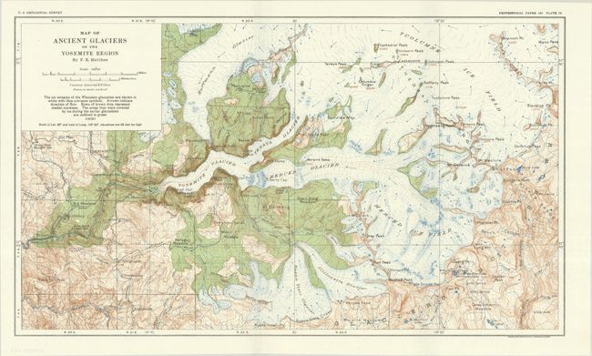
A. Map of Ancient Glaciers of the Yosemite Region (17.6 x 10.3"). This map documents Matthes’ exhaustive research and shows both the ice streams and the direction of flows. Areas in green indicate land that was previously covered in glacial ice. The map also identifies topography via contour lines, peaks, passes, rivers, and more.
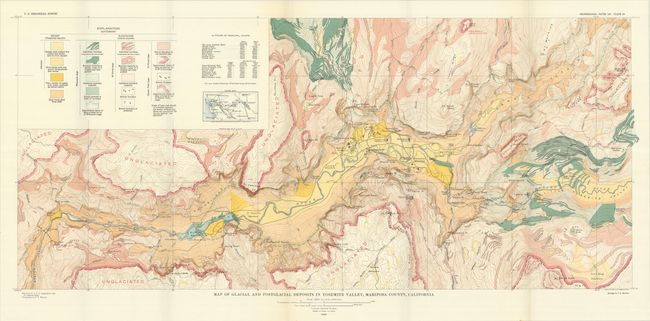
B. Map of Glacial and Postglacial Deposits in Yosemite Valley, Mariposa County, California (35.5 x 15.5"). A large and detailed map presenting the types and sources of glacial deposits and subsequent geologic activity in the Yosemite Valley. Colors and patterns are coded to a large explanation chart at top left. The map also locates modern features such as roads, hotels, lodges, bridges and trails.
References:
Condition: A+
Clean and colorful. Issued folding.