Subject: Santa Clara, California
Period: 1913 (circa)
Publication:
Color: Printed Color
Size:
27.5 x 20.3 inches
69.9 x 51.6 cm
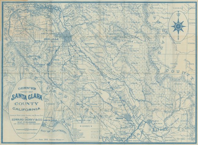
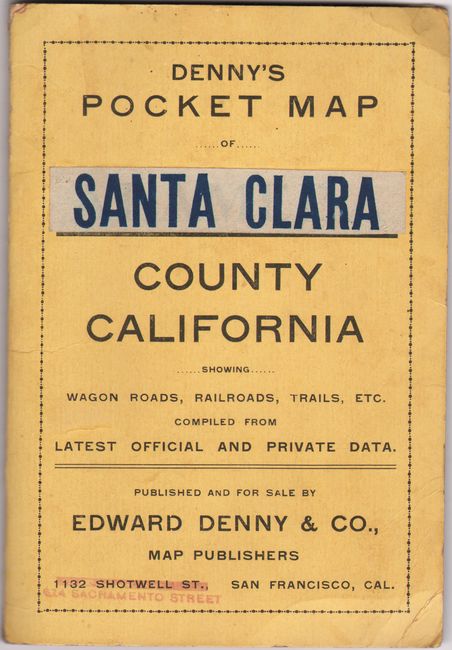
This scarce and unusually detailed pocket map of Santa Clara County was published by Edward Denny & Co. in San Francisco. Printed in blue ink, the map is divided into townships and identifies roads, private roads, railroads, electric railroads, power lines, mines, trails and more. The street-grid patterns of Gilroy, San Jose and Santa Clara are all depicted along with the boundaries of many ranchos. Decorated by an elaborate compass rose at upper right and large circular title cartouche at lower left. Folds into printed paper wrappers (4.3 x 6.3"). Santa Clara County's population was about 90,000 at the time of publication compared to nearly 2 million today.
References:
Condition: A
Issued folding on a bright sheet with a few faint spots. Covers have light wear.