Subject: San Francisco, California
Period: 1868 (circa)
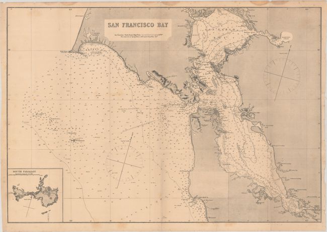
Publication: Sailing Directions for the West Coast of North America...
Color: Black & White
Size:
24.1 x 16.6 inches
61.2 x 42.2 cm
This scarce chart appeared in Imray's Sailing Directions for the West Coast of North America Between Panama and Queen Charlotte Islands. It covers the region from Drake's Bay south to Alviso. The cities of San Francisco, Oakland, and Vallejo are presented in miniature plan form. There is excellent detail of the various bays, with soundings, shoals, bottom types, and other navigational information. At bottom left is an inset of South Farallon Island. The chart originally appeared as a large inset on Imray's impressive chart West Coast of North America From San Blas to San Francisco (1870); this standalone edition is scarce on the market.
References:
Condition: B
A dark impression on a lightly toned sheet with a 3" edge tear at right and a few short fold separations that have been closed on verso with archival materials. There is a bit of light foxing, and light dampstaining that is confined to the upper blank margin.