Subject: San Francisco, California
Period: 1859 (dated)
Publication:
Color: Black & White
Size:
38.9 x 23.5 inches
98.8 x 59.7 cm
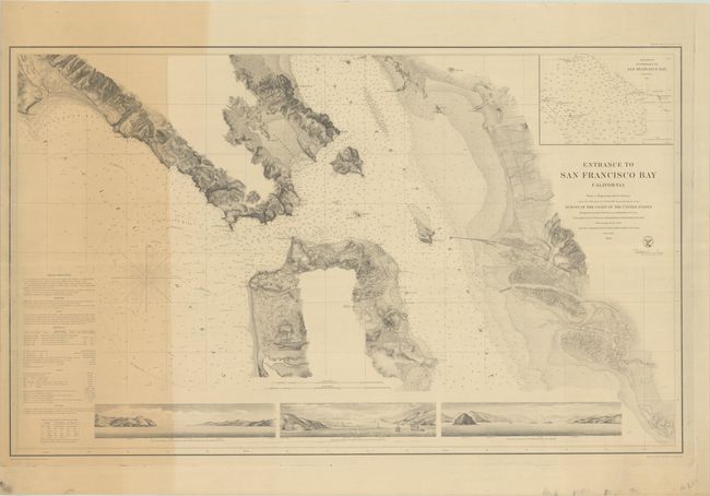
This uncommon, separately issued chart of San Francisco Bay spans from Bolinas Bay to San Leandro. San Francisco and Oakland are both laid out in grid plans, and Brooklyn and Alameda are located as well. There is fine topographical detail along the coast, but the emphasis here is on navigational information. The waters are teeming with depth soundings, bottom types, banks, hazards, and more, with sailing directions and information on light houses and tides appearing at bottom left. An inset, "Sub-Sketch of Entrance to San Francisco Bay," fills the top right corner. The chart is based on the U.S. Coast Survey's Preliminary Chart of Entrance to San Francisco Bay California (1856) with updates and the addition of three fantastic coastal views along the bottom. The views depict San Francisco Bay from Alcatraz and Yerba Buena Islands, as well as San Pablo Bay from Angel Island.
References: Rumsey #1032.
Condition: B
On heavy paper with uneven toning at left and marginal soiling. The chart has been stored rolled and does not lay flat on its own.