Subject: Alabama
Period: 1827 (published)
Publication: A Complete Historical, Chronological, and Geographical American Atlas
Color: Black & White
Size:
9.2 x 11.9 inches
23.4 x 30.2 cm
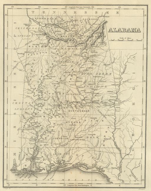
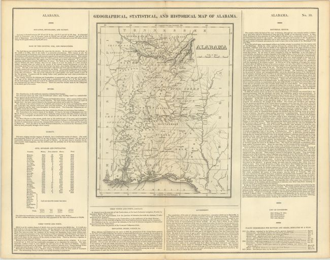
This early map of Alabama is on a full folio sheet (21.9 x 17.5") with English text below and on sides concerning the state's topography, climate, population, history, and other fascinating information. County development is current to 1825, with the additional of Dale County in the southeastern part of the state. Indian lands are located, with an area in the western part of the state for the Choctaws and the unorganized area to the east split between the Cherokees and Upper Creeks. The map extends to show part of Mississippi, Georgia, and East and West Florida. Roads are shown including Gaines's Road and Jackson's Road, referring to future president Andrew Jackson's return route from the Battle of New Orleans, the last major battle of the War of 1812. Drawn by J. Drayton and engraved by J.H. Young.
This is the first time we have encountered this map in black & white.
References: Phillips (Atlases) #1177-30.
Condition: A
A crisp impression on a clean sheet with a few tiny holes along the centerfold.