Catalog Archive
Auction 208, Lot 204
Unrecorded Maps of Hell’s Canyon Snake River 1899
"[Lot of 2] Map of Snake River from Lewiston to the Mouth of the Salmon River [and] Reconnaissance Map of Snake River from the Mouth of Salmon River Up to Pittsburg Landing…", U.S. Corps of Engineers
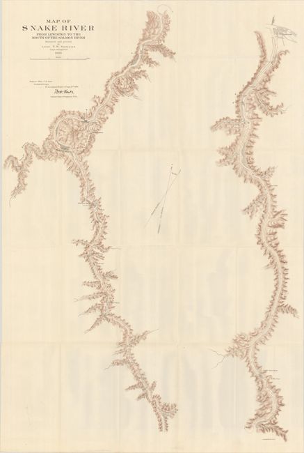
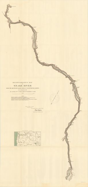
Subject: Northwestern United States, Idaho
Period: 1899 (dated)
Publication:
Color: Printed Color
Size:
See Description
Download High Resolution Image
(or just click on image to launch the Zoom viewer)
(or just click on image to launch the Zoom viewer)