Subject: Western United States
Period: 1799 (circa)
Publication: Voyage de Decouvertes a l'Ocean Pacifique du Nord
Color: Black & White
Size:
20 x 14.9 inches
50.8 x 37.8 cm
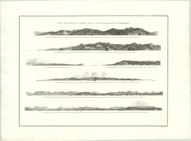
This finely engraved sheet presents a series of seven coastal profiles along the northwest coast of America, issued in a French edition of Vancouver’s Voyage of Discovery. Combining his own explorations with earlier Spanish and British discoveries, George Vancouver, who had sailed with Captain Cook on his third voyage, compiled the best delineation of the Pacific Northwest at the time. The views depict Cape Mendocino, Cape Orford (two views), Cape Gregory, Pointe Grenville, and two views of the Straits of Juan de Fuca and Cape Flattery. The profiles illustrate the varied coastal terrain from northern California to the Pacific Northwest, with rolling headlands, rugged cliffs, and distant mountainous backdrops. Each view is annotated with bearings and distances, reflecting their practical use in identifying landfalls and navigating these often hazardous shores.
References:
Condition: A
A crisp impression on a bright sheet. There are two tiny wormholes adjacent to the right border.