Catalog Archive
Auction 208, Lot 197
"[Lot of 2] Sections on the Missouri River from No. 1 M, to No. 19 M [and] ... from No. 20 M, to No. 40 M", Owen, David Dale
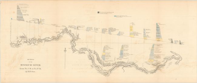
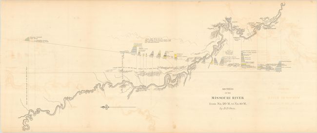
Subject: Missouri River
Period: 1852 (published)
Publication:
Color: Hand Color
Size:
26.3 x 11.5 inches
66.8 x 29.2 cm
Download High Resolution Image
(or just click on image to launch the Zoom viewer)
(or just click on image to launch the Zoom viewer)