Subject: Central United States
Period: 1857 (dated)
Publication:
Color: Hand Color
Size:
20.6 x 20.6 inches
52.3 x 52.3 cm
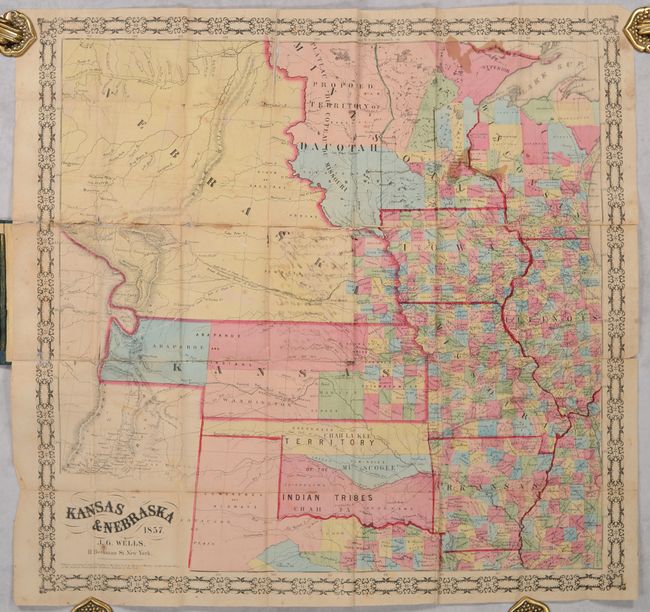
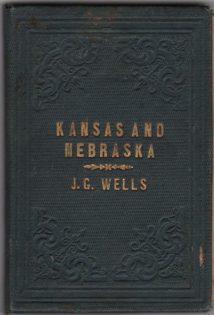
This rare pocket map was produced by J.G. Wells and published by Morse & Gaston in New York. It was issued only 3 years after the creation of these two new territories and was met with considerable public interest given the politics involved in the region. Development is confined to the eastern quarter of Kansas and a small band in the southeast corner of the massive Nebraska Territory. The map names Lecompton, Topeka, Tecumseh, Nebraska City, Omaha City, Bellevue and many more. To the north is the large Minnesota Territory extending to the Missouri River with the western portion representing the "Proposed Territory of Dacotah." To the south is the "Territory of the Indian Tribes," which is divided among the Five Civilized Tribes. Extending west is the "Great Emigrant Route to Oregon and California", Lewis & Clark's route along the Missouri River, and the proposed "Central Rail Road Route to the Pacific." Surrounded by a decorative border and fancy titling. Folds into green cloth boards with gilt title on the front cover.
We found only one past sales record for this 1857 edition map in the last 30 years and no institutional examples. We located 7 examples of the 1856 edition and 1 example of an 1858 edition on OCLC.
References: cf. Rumsey #4933 (1856 edition).
Condition: B
Issued folding with contemporary color. There is some light staining, manuscript notations on verso that show through at center, and a number of fold separations that have been partially repaired on verso. A 4" and 2.5" tear in western NE/KS have also been repaired. A couple of separations in the left margin have been repaired on recto. Covers have minor wear and soiling.