Subject: Central United States
Period: 1855 (dated)
Publication: Atlas of the World
Color: Hand Color
Size:
15.9 x 12.9 inches
40.4 x 32.8 cm
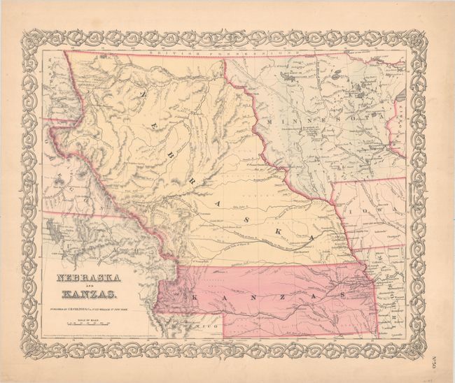
This is the first edition of this important and early map of the transitional territories of Nebraska andKanzas. In 1854, the United States passed An Act to Organize the Territories of Nebraska and Kansas with this configuration. That act also repealed the Missouri Compromise, allowing slavery in the territories north of the 36° 30´N latitude, provoking violence in the region between pro-slavery and anti-slavery settlers. Nebraska is shown as a massive territory - its northern border extends to Canada and incorporates the Dakotas west of the Missouri, Wyoming and part of Colorado. Kansas also reaches west to include part of present-day Colorado. Minnesota Territory is shown at its largest extent, with its western border on the Missouri River. The territories are filled with Indian tribes, forts, and a few settlements concentrated along the major rivers. The explored routes for the proposed Pacific railroads are shown. In present-day Wyoming, the Rattlesnake Mountains make their first appearance on an atlas map. The map is surrounded in Colton's trademark strapwork border with blank verso.
References:
Condition: A
Contemporary color with a bit of toning and soiling in the margins. Two tiny edge tears in the right blank margin have been closed on verso with archival tape.