Catalog Archive
Auction 208, Lot 190
"Rand McNally Official 1922 Auto Trails Map District No. 21 State of Florida [on verso] Rand McNally Official 1922 Auto Trails Map District No. 21 Florida Georgia Alabama So. Tennessee So. No. Carolina Mississippi So. Carolina S.E. Louisiana", Rand McNally & Co.
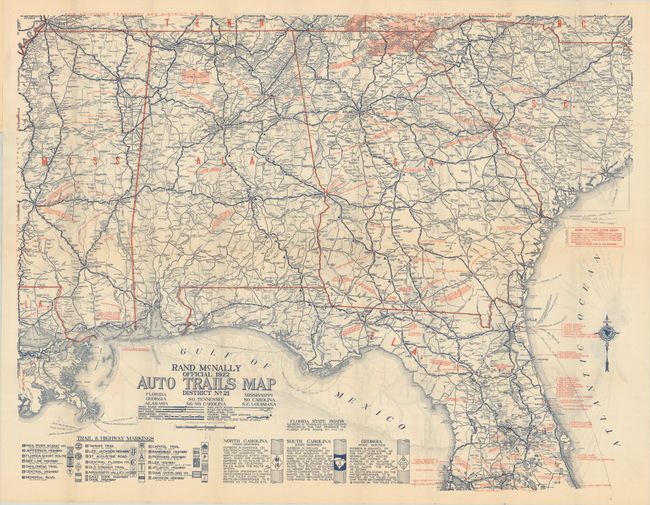
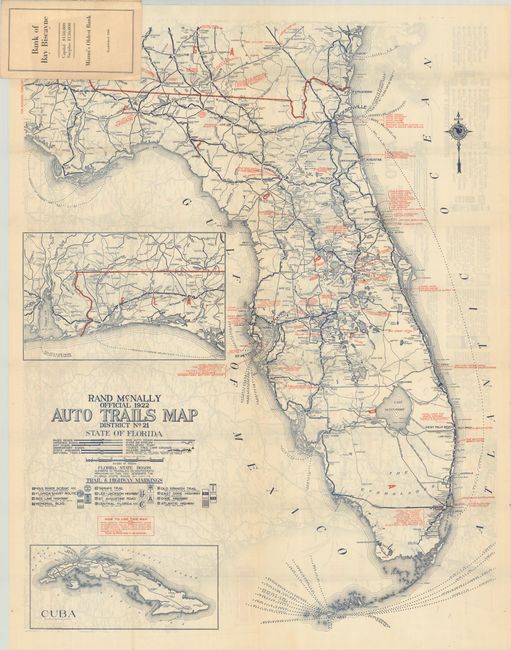
Subject: Southern United States, Florida
Period: 1922 (dated)
Publication:
Color: Printed Color
Size:
25.5 x 32.3 inches
64.8 x 82 cm
Download High Resolution Image
(or just click on image to launch the Zoom viewer)
(or just click on image to launch the Zoom viewer)