Current Auction
Lot 189
Current Auction

"Perrine's New Military Map Illustrating the Seat of War", Perrine, Charles O.

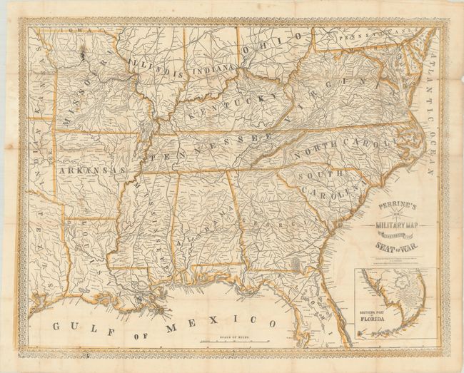
Subject: Southern United States, Civil War

Period: 1862 (dated)

Publication:

Color: Hand Color

Size:
29 x 23 inches
73.7 x 58.4 cm
Download High Resolution Image
(or just click on image to launch the Zoom viewer)

This large Civil War-era map shows the Southern States, with good detail of towns and cities, rivers, and railroads. It extends as far north as the Iowa-Missouri border and includes sections of Texas, Indian Territory, and Kansas in the west. State borders, coasts, and forts are highlighted in orange. An inset below the title at bottom right extends coverage to the southern tip of Florida. Surrounded by a decorative border.

References: Stephenson (CW) #31.1.

Condition: B+

Issued folding, now flat, with archival repairs to short separations and small holes along the folds, light offsetting, and a few spots, including an inky area at top left.

Estimate: $400 - $475

Price: $300

Bid Increments
$100 - $249$10
$250 - $499$25
$500 - $999$50
$1,000 - $2,499$100
Terms & Conditions