Catalog Archive
Auction 208, Lot 187
Important Revolutionary War-Era Chart of Colonial Louisiana and Florida
"Carte d'une Partie des Cotes de la Floride et de la Louisiane. Contenant le Cours du Mississipi, Depuis ses Embouchures Jusqu'a la Riviere Rouge, l'Entree de la Mobile, et les Baies de Pensacola, de Ste. Rose et de S. Joseph...", Sartine
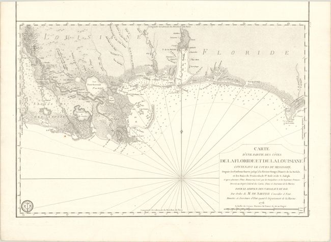
Subject: Colonial Southern United States
Period: 1778 (dated)
Publication: Depot des Cartes et Plans de la Marine
Color: Black & White
Size:
22.9 x 15.4 inches
58.2 x 39.1 cm
Download High Resolution Image
(or just click on image to launch the Zoom viewer)
(or just click on image to launch the Zoom viewer)