Subject: Colonial Southern & Central United States
Period: 1757 (dated)
Publication: Prevost's Histoire Generale des Voyages
Color: Hand Color
Size:
12 x 8.8 inches
30.5 x 22.4 cm
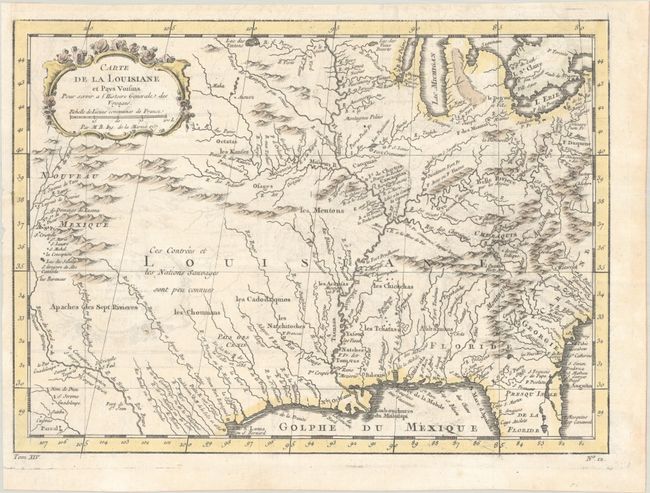
This finely engraved French and Indian War period map of French Louisiana is based on a map by Delisle. It extends from the Great Lakes to the Gulf of Mexico and from Nouveau Mexique to Florida (not showing the tip of Florida). The Mississippi River flows dramatically down the center of the map with tributaries including the Ohio River (l'Oyo ou la Belle Riviere), Missouri River, and the Riviere de Moingona in the area of modern-day Des Moines. The map is filled with place names including many Indian tribes, missions, forts, and early settlements. Nouveau Mexique in the far west includes Santa Fe and names the S. Jerome de Taos. Adorned with a rococo-style title cartouche including a distance scale.
References: Sellers & Van Ee #74.
Condition: B+
Issued folding on a sheet with a bunch of grapes watermark and minor offsetting. A binding trim in the top left margin has been replaced with old paper.