Subject: New Hampshire & Vermont
Period: 1838 (dated)
Publication: An Illustrated Atlas, Geographical, Statistical, and Historical, of the United States...
Color: Hand Color
Size:
11.3 x 14.4 inches
28.7 x 36.6 cm
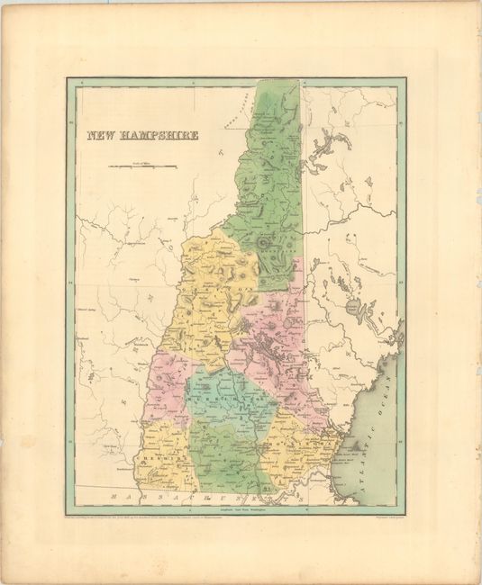
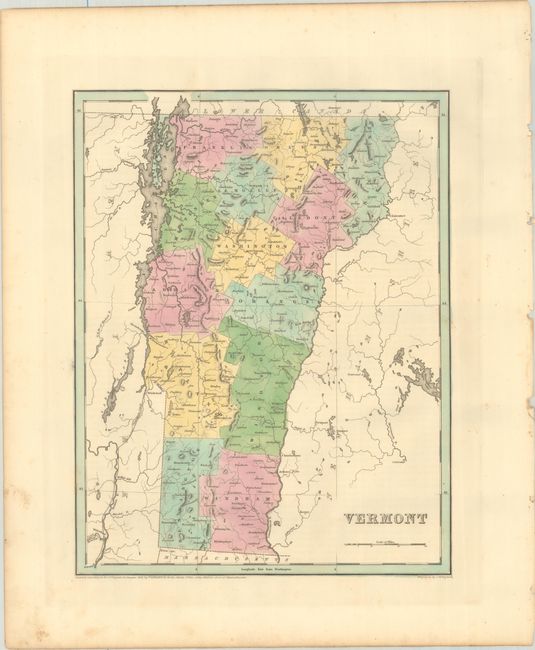
An attractive pair of maps issued in Bradford's An Illustrated Atlas. Larger and more detailed than Bradford's Comprehensive Atlas, each map identifies counties, county seats, wagon roads, rivers, and more. Engraved by G.W. Boynton.
New Hampshire. County configuration is current to the date on the map. An early railroad connects Portsmouth to Newburyport, Massachusetts. In the north is a "Boundary Claimed by Great Britain" and two Dartmouth College grants.
Vermont. County configuration is also current with 14 counties. The Champlain Canal is shown connecting Lake Champlain to the Hudson River.
References: Phillips (Atlases) #1381; Ristow pp. 270-271.
Condition: A
Crisp impressions with contemporary color. There is minor foxing confined to the blank margins.