Subject: Eastern United States, Texas
Period: 1843 (dated)
Publication:
Color: Hand Color
Size:
33.9 x 24.3 inches
86.1 x 61.7 cm
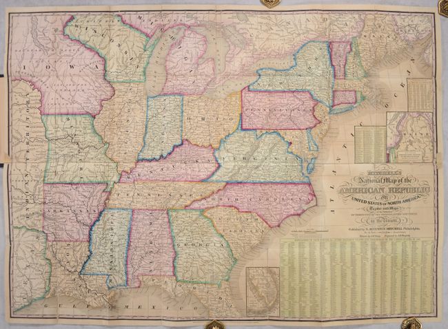
This two-sheet map, drawn by J.H. Young and engraved by J.H. Brightly, is in the scarce pocket form of a map that was typically issued as a wall map. It extends from the Atlantic Ocean west into the eastern part of the Independent Republic of Texas and the large Indian Territory. On this early edition Minnesota is not named, and west of Wisconsin is the huge Iowa Territory that is also labeled Dacotah or Sioux. Includes a small inset "Map of the North-Eastern Boundary of the United States according to the Treaty of 1842" that details the Webster-Ashburton Treaty, and another inset "Map of the Southern Part of Florida" that shows no settlements of any kind south of Fort Jupiter. The map is very detailed with hundreds of place names, plus roads, villages, railroads, ports, etc. A table gives the 1840 population for 120 cities and another gives the states' population of Whites, Free Blacks and Slaves. The state of New Hampshire is listed with just one slave and 537 Free Blacks.
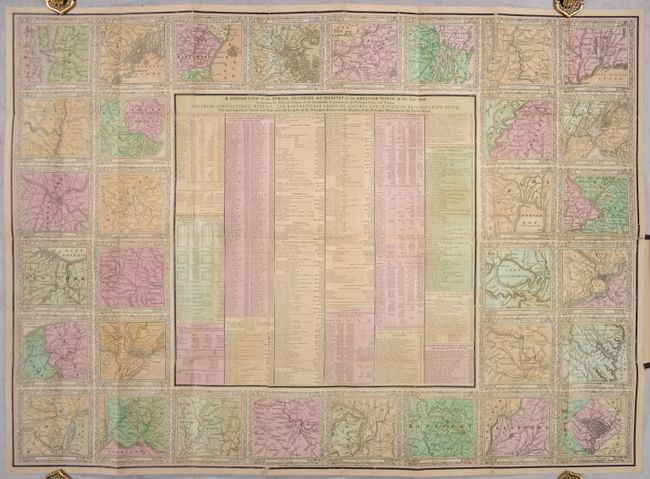
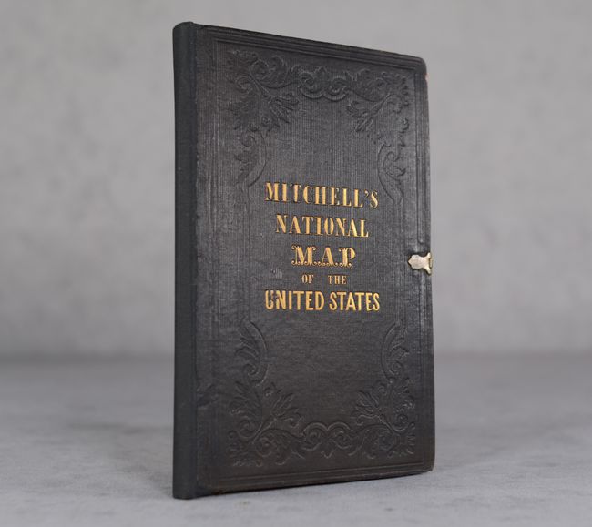
Included with the map is a second sheet with 32 different city views, each with its own decorative border. At the center of the sheet is "A Concise View of the Number, Resources, and Industry of the American People, in the Year 1840." which is not a part of the wall map. Folds into brown cloth boards with gilt title on the front cover and original brass closures.
References:
Condition: B
Issued folding with contemporary color and numerous fold separations that have been repaired on verso with archival tape. Small chips in the left and right borders of the map have been replaced with paper with some small loss of border. The sheet containing the city plans also has some minor losses along a few folds that have also been repaired with paper. Minimal wear to covers.