Subject: United States
Period: 1964 (dated)
Publication:
Color: Printed Color
Size:
35.3 x 23.5 inches
89.7 x 59.7 cm
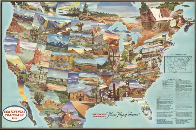
This unusual pictorial map was designed by Bill Taylor for Continental Trailways. It presents America as you might see it from the windows of a Continental Trailways bus, with each of the lower forty-eight represented by a sumptuously illustrated landscape. A key at bottom right identifies each view. Among the sights to be seen are the spires of Bryce Canyon, Indian Head Rock in the Badlands, the Alamo, the blue hills near Cumberland Gap, Magnolia Gardens near Charleston, and the Saco River in Maine. The map also extends to show 9 locations in Canada and 10 in Mexico.
References:
Condition: A
A crisp, clean example with a few short separations at the fold junctions. Issued folding.