Subject: United States, Aviation
Period: 1962 (circa)
Publication:
Color: Printed Color
Size:
34.9 x 24 inches
88.6 x 61 cm
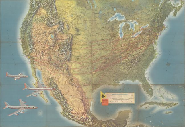
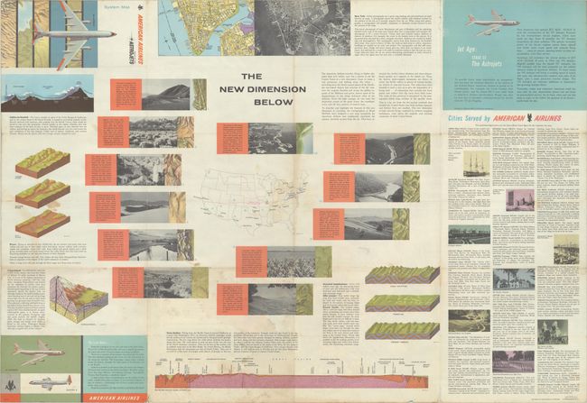
This handsome air route map from American Airlines highlights their new "Astrojets." Text on verso touts the beginning of "Jet Age: Stage II," first with the 707 Astrojet (first introduced in 1961) and then with the 990 Astrojet, which the copy promises is coming "early in 1962." The map shows a 707 and a 909 alongside the Elektra II at bottom left. American Airlines routes are highlighted in red throughout the United States and Mexico, spanning as far south as Mexico City. The legend identifies cities served by American Airlines, American Airlines airports, other major airports, points of interest, railroads, metropolitan areas, and other cities and towns. A diagram shows how much distance each aircraft can cover in 10 minutes, providing passengers with a rudimentary way to clock the duration of their flights. Topography is well-rendered. Self-folding into pictorial wrappers (4.0 x 9.0").
References:
Condition: B
Issued folding with staining and soiling mostly in the bottom right quadrant of the map. There is light toning along the central fold and some tiny abrasions. A few short fold separations, including a 2.5" separation at top left, have been closed on verso with archival tape.