Subject: United States
Period: 1957-60 (circa)
Publication:
Color: Printed Color
Size:
19.9 x 15.1 inches
50.5 x 38.4 cm
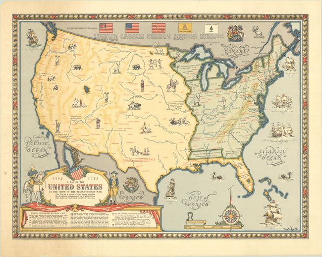
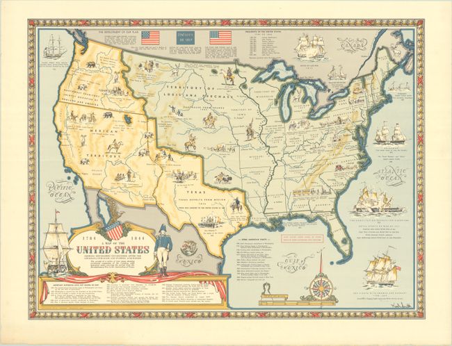
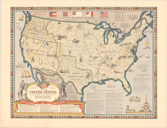
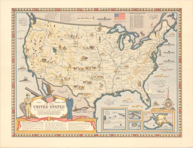
This terrific quartet of maps by Karl Smith combine pictorial and historical elements to present the evolution of the United States from the age of Columbus to the modern era. The maps stick to roughly the same template, depicting the boundaries of the United States and territorial lands at a certain point in history, with the development of the flag along the top of the map, ships from the era in the surrounding waters, and a title cartouche incorporating historical figures and a timeline of important events not shown on the map. The landscape is dotted with illustrations of Indigenous peoples (especially in the West), wild life, important events, and more. All the maps include a scale of miles, an elaborate compass rose, and a decorative border. Copyrighted by Linweave of Springfield, Massachusetts. The maps are as follows:
A. 1492-1783 A Map of the United States at the Close of the Revolutionary War, dated 1957. This map covers early European settlement to the American Revolution, showing the configuration of the new United States at the end of the war.
B. 1784-1844 A Map of the United States Showing Boundaries Established After the Louisiana Purchase and Florida Acquistion, dated 1958. The map shows the Louisiana Purchase and the independent Republic of Texas.
C. 1845-1866 A Map of the United States Showing Boundaries at the Close of the Civil War, dated 1958. The map includes much Civil War information and iconography.
D. 1867-Space Age A Map of the United States and Possessions, Including Alaska and Hawaii, circa 1960. This map takes us from Reconstruction to the atomic bomb. There are insets showing American territories in the Pacific, the Panama Canal Zone, Puerto Rico and the Virgin Islands, and Alaska.
References: Rumsey #11180.004-007.
Condition: A
All the maps except for the third one are on sheet with a Linweave watermark. The maps are near fine, with just minor foxing and a hint of soiling on the first map.