Subject: United States
Period: 1955 (dated)
Publication:
Color: Printed Color
Size:
10.5 x 7.8 inches
26.7 x 19.8 cm
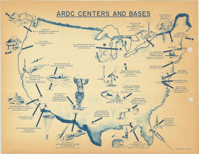
The U.S. Air Force Air Research and Development Command (ARDC) was created in 1951 to centralize aerospace research and development under one command. This small map of the United States locates the various ARDC centers and, echoing the mid-20th century popularity of pictorial maps, illustrates the focus of each center. The largest illustration is an atomic bomb explosion near Kirtland AFB in New Mexico. Several other sites were testing pilotless aircraft and missiles, including one in New Mexico that appears to use rail delivery. Unlike the other bases, the Indian Springs AFB in Nevada is shown with no special focus. However, it is nearby Area 51, not shown on the map, where ARDC tested the U-2 high altitude reconnaissance aircraft in the 1950s. This map, with blue coloring, was likely not produced for general distribution during the Cold War. We found no examples for this map on OCLC.
References:
Condition: B
There is some toning primarily along the sheet edges and two punch holes along the right side in blank areas.