Current Auction
Lot 137
Current Auction

Scarce Railroad Map with Bizarre Depictions of Montana and Wyoming. Colorado Is Off the Map!

"Great Northern Railway Line and Connections", Railroad Companies, (Various)

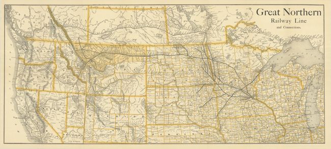
Subject: Western United States & Canada, Railroads

Period: 1890 (circa)

Publication: Seventh Annual Report of the Trade and Commerce of Minneapolis

Color: Printed Color

Size:
35.6 x 15.6 inches
90.4 x 39.6 cm
Download High Resolution Image
(or just click on image to launch the Zoom viewer)

This excellent railroad map shows the Great Northern and its connections in bold black line, extending from Duluth and the Twin Cities to the west coast. The map covers from Lake Michigan to the Pacific, and spans north into southern Canada. It is distinguished by its distorted depiction of Montana and Wyoming. Montana's southern border is even with Idaho's southern border, and the northern part of the state is labeled "All Free Land." Wyoming is enlarged so that it pushes Colorado off the map and appears to border Arizona. Published in Seventh Annual Report of the Trade and Commerce of Minneapolis for the Year Ending December 31, 1889.

References:

Condition: A+

Fine. Issued folding.

Estimate: $250 - $325

Current High Bid:
$0

Reserve: Reserve Not Met
Next Bid: $130

Bid Increments
$100 - $249$10
$250 - $499$25
$500 - $999$50
$1,000 - $2,499$100
Terms & Conditions