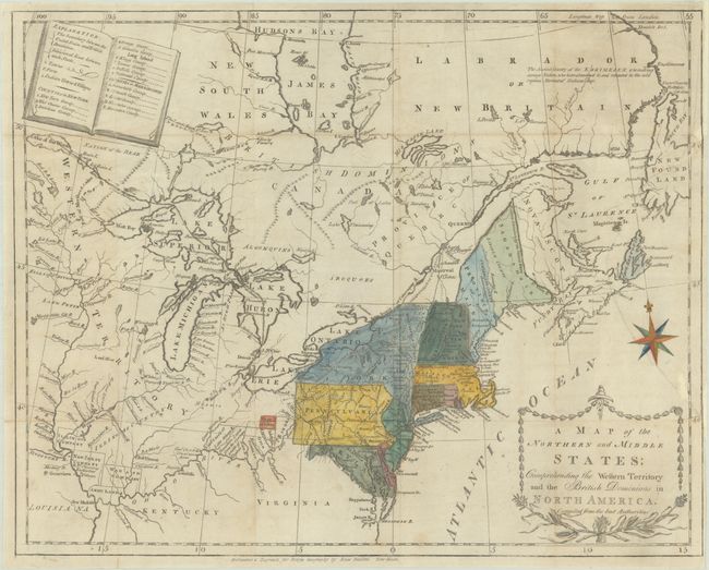
Subject: Northeastern United States & Canada
Period: 1789 (published)
Publication: Morse's The American Geography
Color: Hand Color
Size:
15.6 x 12.4 inches
39.6 x 31.5 cm
This is the first state of this uncommon and information-packed map. It depicts the region from James Bay to the Chesapeake Bay and west to the confluence of the Mississippi and Ohio rivers. An explanation of the various symbols used in the map is displayed in the form of an open book in the upper left corner. Several of the districts and states are shown with distorted borders, but the most interesting feature of the map are the numerous Bounty Land Grants shown in the western frontier including Genl Clarks, Donation Lands from the Commonwealth of Virginia, Ohio Company in Ohio, and Wabash Company, New Jersey Company, and Illinois Company in Illinois. Adorned by a decorative title cartouche and compass rose in the Atlantic. Drawn and engraved by Amos Doolittle.
References: McCorkle #789.6; Kershaw #385; Sellers & Van Ee #194; Wheat & Brun #149.
Condition: B
Issued folding, now flat, on a sheet with a "C & I. Honig" horn coat of arms watermark. There is a large chip at right that has been professionally reattached with a tiny portion of border in facsimile. Narrow right margin.